URGENT UPDATE: Alabama residents are bracing for a cold start to the work week as temperatures are set to plummet into the 30s and 40s tonight. The National Weather Service has confirmed that a wave of chilly air will sweep across the state, prompting the potential for frost in northern and central Alabama.
Rain is expected to fall primarily in northeast Alabama today, with the highest chances occurring throughout the day. Most of the state, however, will remain dry, with high temperatures struggling to reach the 50s in the northern and central regions.
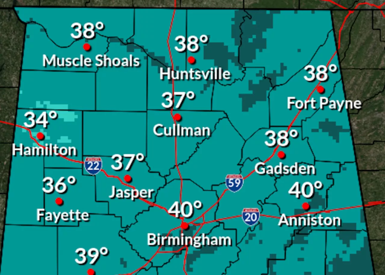
Forecasters warn that as temperatures drop this evening, lows will dip into the 30s in the north and the low to mid-40s in the south. This sudden chill could lead to frost conditions, particularly for areas in the north, while parts of the south may see some patchy frost.
Looking ahead, the weather service projects a significant warmup beginning tomorrow, with temperatures expected to climb back into the 60s, 70s, and even the 80s by the end of the week. No rain is forecast until at least Friday, when only northern parts of the state may see slight chances of precipitation.
By Friday, highs will range from the low 70s in the north to the upper 70s in the south, where some areas could even reach the 80-degree mark. Saturday will continue this trend with temperatures peaking in the low to mid-70s across the state.
The Climate Prediction Center has also released an eight- to fourteen-day forecast, indicating that Alabama will likely experience above-average temperatures from November 9-15. Most of the state holds a 40-50 percent probability for warmer weather during this timeframe, with parts of west Alabama seeing even higher odds of 50-60 percent.
As the chill settles in today, residents should prepare for a swift transition to milder weather later this week. Stay tuned for updates as conditions develop. Share this urgent weather alert with friends and family to keep everyone informed!