URGENT UPDATE: An intense Arctic air mass has descended on the Lehigh Valley, Poconos, and northwestern New Jersey, bringing life-threatening conditions and potentially record-setting low temperatures through the end of the week. Forecasters have warned that wind chills could plunge to negative 20 degrees Fahrenheit in some areas, creating severe risks for health and infrastructure.
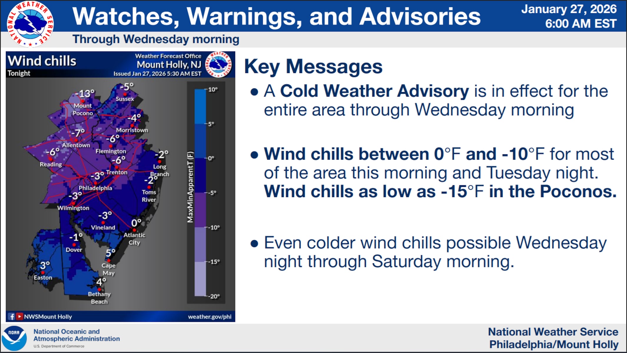
As of now, the National Weather Service has issued a Cold Weather Advisory valid until 10 a.m. Wednesday, emphasizing the critical dangers posed by the extreme cold. With highs barely reaching 20 degrees and overnight lows expected to drop below zero, residents are urged to take immediate precautions. Wind chills across the region will likely range from zero to negative 10 degrees Fahrenheit, with the Poconos experiencing even harsher conditions.
This Arctic blast follows a substantial snowfall event on January 25, when 11.8 inches of snow fell at Lehigh Valley International Airport, setting a new record for the date. Meteorologists are now monitoring the potential for another snowstorm this weekend, with probabilities for snowfall ranging from 20 to 50%, depending on the specific location.
Residents must limit outdoor exposure and dress in layers to prevent frostbite and hypothermia. Conditions from Wednesday through Friday are expected to remain brutal, with daytime highs in the mid to upper teens and consistent overnight lows in the single digits or below zero. Wind gusts may exacerbate the situation, pushing wind chills to dangerously low levels, particularly north of the I-95 corridor.
The threat of record-breaking low temperatures looms, with local weather stations potentially setting new benchmarks for both low temperatures and low maximum temperatures. It is crucial for residents to prepare for prolonged cold spells by ensuring heating systems are functioning, protecting vulnerable pipes, and checking on elderly neighbors and pets.
Meteorologists stress that the cold air mass will persist into early next week, maintaining frigid conditions that could challenge past climate records. Residents should stay tuned for updates on the potential coastal storm expected next weekend, which could bring more snow to the already impacted areas.
Stay safe and warm, and share this urgent update with friends and family to ensure everyone is prepared for the severe weather ahead.