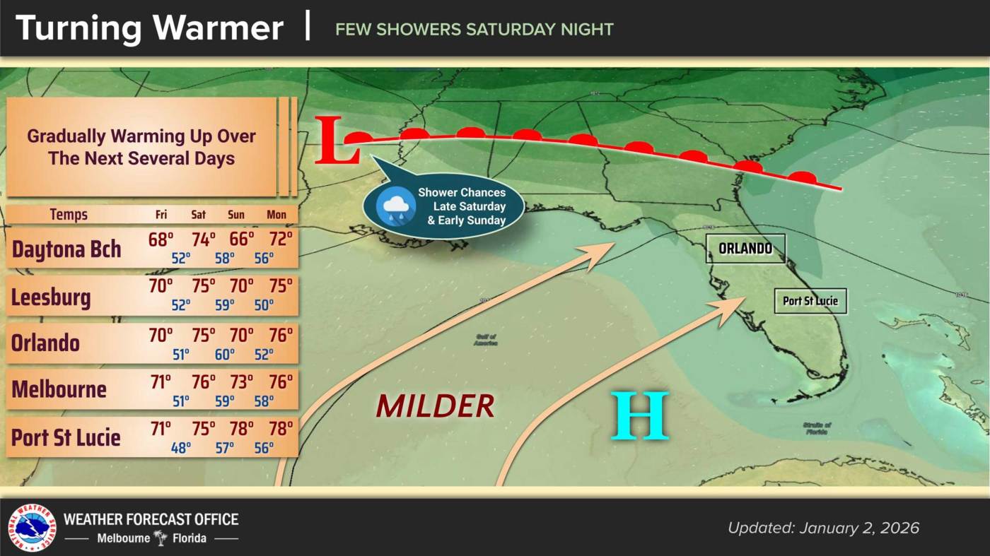
URGENT UPDATE: Central Florida is experiencing a rapid temperature rise today, with highs expected to reach around 70°F as the region gears up for the weekend. The National Weather Service in Melbourne warns that the warm-up will be short-lived, as a cold front is set to sweep through the Southeast U.S. by Sunday, bringing a chance of rain and cooler temperatures.
As of Friday morning, dry weather prevails across the Sunshine State, with high pressure moving eastward and light westerly winds. However, conditions are expected to shift significantly as clouds increase overnight. The NWS notes that while most areas will enjoy pleasant weather today, overnight lows will dip to the upper 40s, with some rural regions south of I-4 potentially falling into the mid-40s.
Saturday’s forecast calls for a high of mid-70s before the cold front moves in Saturday night. The NWS described a “southwesterly flow” that will increase winds in the afternoon to around 10-15 mph north of I-4, with gusts reaching near 20 mph.
The cold front, following a trough from the Tennessee Valley, is expected to introduce scattered showers late Saturday into Sunday. Despite the incoming front, a significant temperature drop is not anticipated. Sunday’s highs will remain in the 70s for most of Central Florida, but areas north of I-4 could see temperatures dip into the upper 60s, with overnight lows forecast in the 50s.
Looking ahead to next week, Central Florida will continue to heat up, with temperatures climbing to the upper 70s and even lower 80s by Thursday. The NWS reports that coastal locations will see lows staying in the lower 60s, providing a warm reprieve after the weekend chill.
Residents are encouraged to stay informed as this weather pattern develops, as the shifting temperatures could impact weekend plans. Keep an eye on local forecasts for the latest updates on this rapidly changing weather situation.