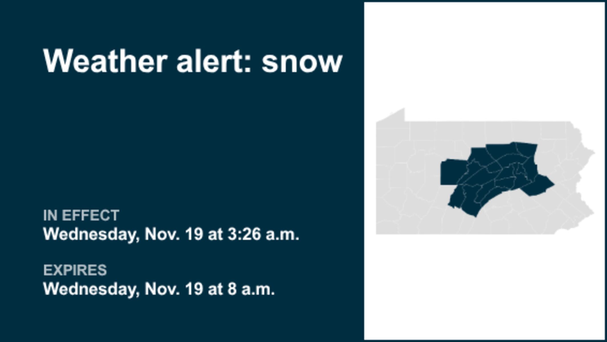
UPDATE: A significant winter weather alert has just been issued for Central Pennsylvania, with the National Weather Service confirming snow is expected until 8 a.m. today. Areas affected include Northern Clinton, Northern Centre, Southern Centre, Northern Lycoming, Southern Clinton, and Southern Lycoming counties, along with Clearfield, Blair, Huntingdon, Mifflin, Juniata, Sullivan, Union, Snyder, Montour, Northumberland, Columbia, and Schuylkill counties.
The NWS reports that a compact but potent weather disturbance is moving east from South-Central PA towards the Southern Poconos. Residents can expect a period of accumulating wet snow during the early to mid-morning hours, with snow likely to stick on untreated roads, creating slushy and potentially hazardous driving conditions. Snow accumulations on colder surfaces are projected to be between 1 to 2 inches.
IMPORTANT: Snowfall is expected to diminish west of Interstate 99 between 4 and 5 a.m. but will remain more concentrated across the Middle Susquehanna Valley and Western Poconos from 5 to 8 a.m. This brief winter weather event will significantly impact the mid-morning commute, particularly for those traveling southeast of a line drawn from Altoona to State College and Williamsport.
Authorities urge commuters to exercise caution if travel is necessary. The NWS advises, “Slow down and allow plenty of stopping distance between you and the vehicle ahead. Avoid braking suddenly.” As conditions worsen, the risk of accidents increases, making it critical for drivers to prepare for slick roads.
Stay tuned for further updates as conditions evolve. This snow system is a reminder of winter’s early arrival in the region, and residents are encouraged to stay informed and prioritize safety during their morning routines.